
Extensive drought in Midwest spares much of the UP
Meteor shower to reach its peak this weekend
Trending
IRON MOUNTAIN -- Unlike much of the Midwest, the Upper Peninsula is free of drought apart from the southern tier.
As of Thursday, the U.S. Drought Monitor showed abnormally dry conditions in southern Dickinson and Iron counties, along with Menominee County. In the southwestern U.P., Gogebic and Ontonagon counties were in moderate drought. Extreme drought was reported just to the west in Wisconsin in northern Bayfield and Douglas counties.
At Iron Mountain-Kingsford, 5.13 inches of rain fell in July, which was about 1.7 inches above normal. The wet month came after just 0.91 inches of rain in June and 1.78 inches in May.
At Marquette, the National Weather Service reported 4.93 inches of rain in July, 2.65 inches in June and 5.3 inches in May.
Meanwhile, there is some level of drought in nearly all of Wisconsin, along with Minnesota and Iowa and much of Illinois, Missouri and lower Michigan.
Severe to extreme drought expanded across south-central Wisconsin this past week due to dryness dating to late spring.
Despite the weather, the nation's corn harvest could be the second-largest on record, according to Reuters news agency. It's been a roller-coaster season in the corn belt as drought damage from May and June was not as bad as feared.
Field conditions improved in July, Reuters reported, and genetically modified corn allowed the crop to hold on.
For late summer and early fall, the weather service has a neutral outlook on rainfall in the Midwest. Then from November through March, the Climate Prediction Center slightly favors below-normal precipitation across the U.P. and Wisconsin.
The temperature outlook for the Upper Peninsula is neutral through November. For December through February, however, the CPC calls for a 45% chance of above-average temperatures and just a 20% chance of below-average.
El Nino conditions -- a warming of the waters in the Eastern Pacific -- are expected to strengthen and persist through winter, said NWS forecaster Matthew Rosencrans. That indicates "enhanced chances for above-normal temperatures" across the northern tier of the continental U.S. from late fall into spring, he said.
Temperatures in July at Iron Mountain-Kingsford averaged 67.5 degrees, which was about 1 degree below normal. It was the coolest July since 2014, when temperatures averaged 65 degrees.
The highest reading last month at the Iron Mountain-Kingsford Wastewater Treatment Plant was 91 degrees July 5, while the lowest was 45 degrees July 7. There were at least six days in July with substantial rainfall.
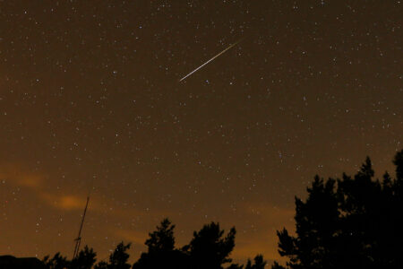
For sky watchers, the annual Perseid meteor shower will reach its peak this weekend. The best viewing should be before 3 a.m.
"You will likely see one meteor every couple of minutes or so if you can get to dark skies away from city lights early in the morning hours," said Shannon Schmoll, professor in the Department of Physics and Astronomy at Michigan State University. "That, combined with the moon rising late and not being as illuminated, makes this a pretty good viewing year."
The event's name gives a nod to meteors radiating from a point in the northern sky from the constellation Perseus.