Blizzard warning to take effect 1 a.m. Sunday
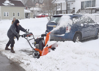
As what is being called a “potentially historic blizzard” bears down on the region, the National Weather Service has issued a blizzard warning from 1 a.m. Central time Sunday through 7 p.m. Monday.
Snowfall totals are expected to range from 2 to 3 feet across the Upper Peninsula, with some areas possibly seeing up to 4 feet — the NWS office specifically named the northcentral and eastern U.P. for these higher amounts. Winds could gust from 35 to 65 mph, with higher speeds on the Keweenaw Peninsula and Lake Superior shores.
Travel should be restricted to emergencies only, NWS advised. If traveling, motorists should have a winter survival kit and stay with their vehicle if they get stranded.
In Wisconsin, where the blizzard warnings extend south to the Stevens Point and Fox Valley areas, Gov. Tony Evers today declared a state of emergency ahead of the storm. The system was expected to affect the entire state.
Local News
Blizzard warning to take effect 1 a.m. Sunday
As what is being called a “potentially historic blizzard” bears down on the region, the National Weather ...
Wisconsin taxpayers can file for free with WisTax
MADISON, Wis. — WisTax, Wisconsin's free and secure electronic income tax filing system, is available for the ...

Danielson Insurance renews Bay IM scholarship
Outdoor education talk on Thursday in Florence
FLORENCE, Wis. — The monthly Florence County outdoor education talk will take place at 6 p.m. Thursday in the ...
Major snowstorm expected to slam region this weekend