
Drought considered severe in southern UP
Trending
IRON MOUNTAIN -- Two months of below-normal rainfall has led to severe drought in parts of Dickinson, Iron and Menominee counties, along with bordering Wisconsin communities.
Locally, September has produced about a quarter-inch of rain since the U.S. Drought Monitor's latest update, but more showers are needed to ease a summer deficit of several inches.
National Weather Service data shows an August rainfall total of 1.31 inches at the Iron Mountain-Kingsford Wastewater Treatment Plant observation site -- more than 2 inches below average. July's 1.3 inches of rain was also more than 2 inches below average.
June was wet, with 5.17 inches of rain.
The National Weather Service has a neutral outlook on Upper Peninsula precipitation for the rest of September. The long-range forecast slightly favors below-normal rainfall in the eastern half of the U.P. through November.
"A slight tilt toward below normal precipitation amounts are forecast across much of the Great Lakes," NWS forecaster Scott Handel said.
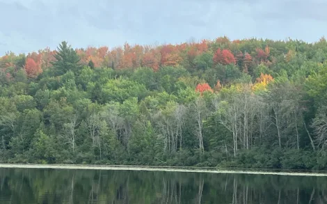
Dry weather may affect the fall color season, as the best displays occur when soil has been adequately moist throughout the year, said Michigan State University-Extension natural resources educator Julie Crick.
"A warm period during the fall can also decrease the intensity of fall colors by triggering early leaf drop before the colors have had a chance to develop," Crick noted.
The smokymountain.com Fall Foliage Map predicts colors reaching a near peak in the southern U.P. by the end of September and moving past their peak by mid-October.
Temperatures at Iron Mountain-Kingsford averaged 68.5 degrees in August, which was 1.8 degrees above average. The highest reading was 87 degrees on Aug. 7 and the lowest was 45 on Aug. 24.
July temperatures averaged 73 degrees -- 4.5 degrees above normal -- while June temperatures were slightly below normal at 63.3 degrees.
NWS's temperature outlook is neutral for September, but slightly favors above-normal temperatures for the rest of the fall.
The U.S. Drought Monitor shows extreme drought in the northwestern corner of Wisconsin, along with the far western portion of Gogebic County.
Farther north from the Wisconsin border, conditions in the U.P. range from moderate drought to abnormally dry, with no concern in much of Delta, Alger and Baraga counties.
The Wisconsin Department of Natural Resources on Friday encouraged boaters to be aware of low water levels. Fall boaters, especially those operating larger watercraft with longer trailers, may experience difficulties launching and retrieving them at shallow boat ramps, the DNR said. Low water levels may also expose additional or unmarked obstructions at the ramp, including stumps, rocks and sand bars.
Autumn officially arrives in the Northern Hemisphere at 7:05 p.m. Central time Tuesday, Sept. 22. As cooler weather approaches, El Nino is strengthening, and the Climate Prediction Center sees a greater than 90% chance of a very strong event extending into winter.
Partly due to that outlook, the U.P.'s winter forecast favors above-average temperatures and slightly favors below-normal precipitation. El Nino is a natural climate pattern characterized by warmer surface waters in the central and eastern Pacific Ocean.
In a news release Thursday, the World Meteorological Association said El Nino is set to become very strong, potentially shifting rainfall and temperature patterns worldwide and fueling extreme weather.
———
Jim Anderson can be reached at 906-774-2772, ext. 85226, or janderson@ironmountaindailynews.com.