Flood warnings to remain in effect through week
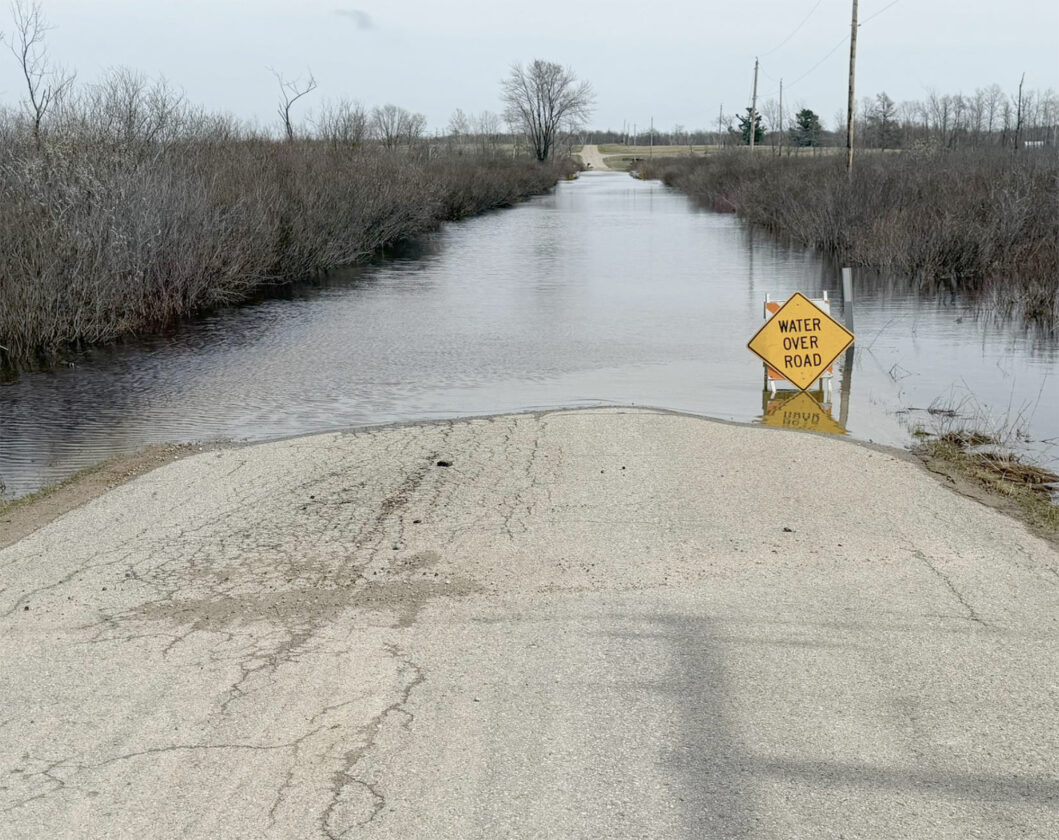
The Menominee County Road Commission on Friday posted this photo of a flooded road. Across the county, three bridge closures and about 10 road closures remained in effect Monday. (Menominee County Road Commission photo)
The National Weather Service on Monday said river flooding in the region, while decreasing, will persist through this week.
Snow melt has resulted in rivers reaching critical levels, forecasters said.
The Dickinson County Road Commission on Monday reopened the Sturgeon River bridge on County Road 577 in Vulcan. The bridge had been closed since Wednesday by flooding and motorists had been asked to use County Road 573 as an alternate route.
NWS flood warnings remain in effect for the Paint, Michigamme, Menominee and Brule rivers.
In Marquette County, NWS said the Michigamme River near Witch Lake on Monday rose to 12 feet. That’s about 3 feet above flood stage and a level at which water covers significant portions of County Road LG between M-95 and the Michigamme Dam.
On the Menominee River below Twin Falls Dam, levels were slightly above flood stage of 20.5 feet. At this level, water approaches structures near Rivers Bend RV Resort and Campground in Breitung Township, NWS said.
Numerous road closures and detours remained in effect in Menominee County, including eastbound and westbound U.S. 2 between U.S. 41 and Pine Avenue in Powers. The U.S. 2 bridge over the Cedar River just north of that location will be closed until the Michigan Department of Transportation evaluates it and can ensure it is safe for public travel, the Menominee County Road Commission said Monday.
Menominee County was on the list of counties declared by Gov. Gretchen Whitmer to be in a State of Emergency on Wednesday. Whitmer on Monday also declared a state of emergency in Iron and Marquette counties due to high water levels making some roads impassable.
“This will help Marquette and Iron counties with ongoing recovery efforts,” Whitmer said in a news release. “As water levels across Michigan stabilize and drop, my administration will continue to work with local communities to get them what they need. I want to thank every first responder who stepped up to protect Michiganders and their property.”
The forecast for the Iron Mountain area is dry until Thursday night when rain is likely, along with possible thunderstorms through Friday.
High temperatures are expected to reach 67 today and Wednesday, and 73 on Thursday. Cooler weather should follow, with a high near 56 on Sunday.
Communities throughout the state have experienced prolonged rainfall, rapid snowmelt, straight-line winds, or tornadoes causing widespread flooding, elevated river levels, and damaged roads, homes, and property.
On April 10, Whitmer activated the State Emergency Operations Center and declared a state of emergency for Cheboygan County due to the threat of overtopping at the Cheboygan Lock and Dam Complex, which remains in effect. On April 14, the governor elevated the SEOC activation to monitor weather-related events statewide.
By declaring a state of emergency, the governor has authorized the use of all available state resources to assist local response and recovery operations in the affected counties.
The Michigan State Police Emergency Management and Homeland Security Division is coordinating the state’s emergency response through the SEOC. MSP troopers are on the ground assisting local emergency response efforts. The declaration also allows eligible communities to seek financial assistance under Section 19 of Michigan’s Emergency Management Act, Public Act 390 of 1976, as amended. The funding helps local governments cover emergency response costs and repair public infrastructure damaged by the storms.
For more information about the statewide response, go to michigan.gov/aprilstorms.
Local News

Sand sculptors bring Bigfoot back to Gladstone Beach

UP sees ‘The Ford Boom’ in the 1920s

An age of innovation in the US
Democratic-led states sue over new Medicaid work requirements
Twenty-five Democratic-led states plus the District of Columbia have sued the Trump administration over its new ...

State appeals court upholds ex-school officer’s sentence for sexual abuse