Wisconsin deals with spring of ‘precipitation ping-pong’
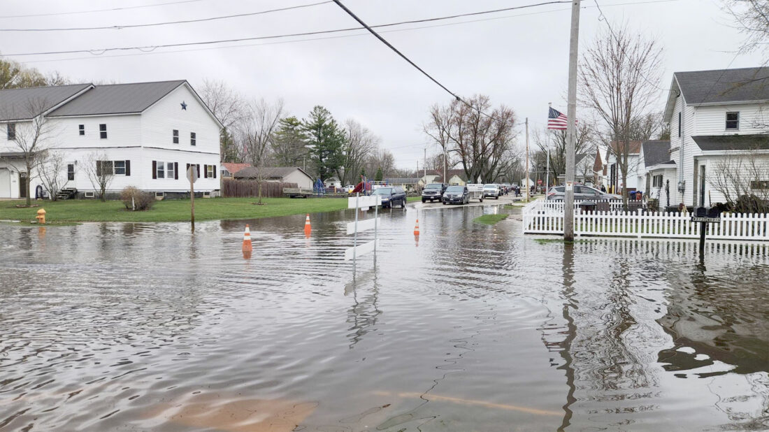
A flooded residential street in Shiocton, Wis., on April 15 in Outagamie County. (Joe Schulz/Wisconsin Public Radio)
It’s going to be harder to predict when severe weather will peak in Wisconsin this summer, after an unusual spring that had Mother Nature playing “precipitation ping-pong,” according to the Wisconsin State Climatology Office.
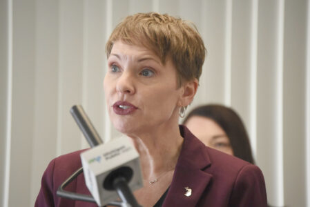
“Our office has nicknamed it — where we seem to go back and forth between a really wet month and then a really dry month,” Climate Outreach Specialist Amanda Latham said.
She told WPR’s “Morning Edition,” that Wisconsin typically sees severe weather ramp up in May and then peak in June or July.
That’s not what’s happening this year.
It was the wettest April on record. The office also reported that more than 280 warnings of tornadoes, storms and flash floods were issued — the highest month record since warnings began in 1986.
“It is really hard to determine an outlook for the rest of the summer season, just based on how incredibly active April was,” she said.
Latham told WPR that June is already seeing severe weather hit parts of central Wisconsin and southern Wisconsin.
“Some rain totals 5 to even 6 inches for the month so far — whereas some areas near Green Bay have been a bit drier,” she said.
Last week, a tornado touched down in Belleville, with no injuries or fatalities reported. The state Climatology Office reports that as of June 15, Wisconsin had 31 confirmed tornadoes. That’s more than the state typically sees all year.
“A lot of it has to do with warm temperatures,” Latham said. “The warmer we are, the more unstable the atmosphere is and that can trigger stronger storms in the state.”
She said both spring and fall temperatures are rising across the state, compared to previous decades.
Latham said despite temperatures, Wisconsin won’t see an impact this summer from the climate phenomenon, El Niño.
“In South America, when those waters are much warmer than average, that triggers an El Niño pattern,” she said. “That influences ocean circulations, atmospheric circulations and the position of the jet stream.”
Latham said some data suggests that may lead to slightly cooler summer conditions, but those trends “aren’t very significant.”
“When we have an El Niño pattern, it causes the polar jet stream to shift a little bit further north, so it essentially locks all of the cold air up into Canada and up into the Arctic.”
She said that causes Wisconsin winters to feel warmer, with less snowfall.
Latham said as June continues, Wisconsinites could be in store for cooler averages. The state average is typically 76 degrees Fahrenheit.
But, looking ahead to July and August, temperatures could go “either way.”
“Unfortunately, it’s undetermined where we’ll fall, but it has been kind of nice to have a little bit of a break from the heat so far this June,” she said.
Last year, the state climatology office reported Wisconsin saw temperatures reach the 90s on June 19 and 22, causing heat indices to exceed triple digits.
The agency also found that, historically, the hottest day of the year in Wisconsin is July 19, with a statewide average high temperature of 82.2.
Latham has previously measured where Wisconsin sees the most 90-degree days in July. Between Eau Claire, Green Bay, La Crosse, Madison, Milwaukee and Wausau — she found that La Crosse typically sees the most 90-degree days, with an average of 17.5 days per year.
Local News
Record-breaking scholarship season for M&M Foundation
MENOMINEE — The M&M Area Community Foundation has completed its 2025–2026 scholarship season, awarding 79 ...

Food, Fun and Fitness
KHS scholarship checks available
KINGSFORD — Kingsford High School has set the schedule for scholarship recipients to pick up their checks at the ...
Hydraulic Falls Road reopened to traffic
IRON MOUNTAIN — Hydraulic Falls Road is now open to traffic, according to the Dickinson County Road ...
Hertel stepping down as state health director