Freezing rain expected in area
Longer forecast for spring suggests below-normal flood risk in region
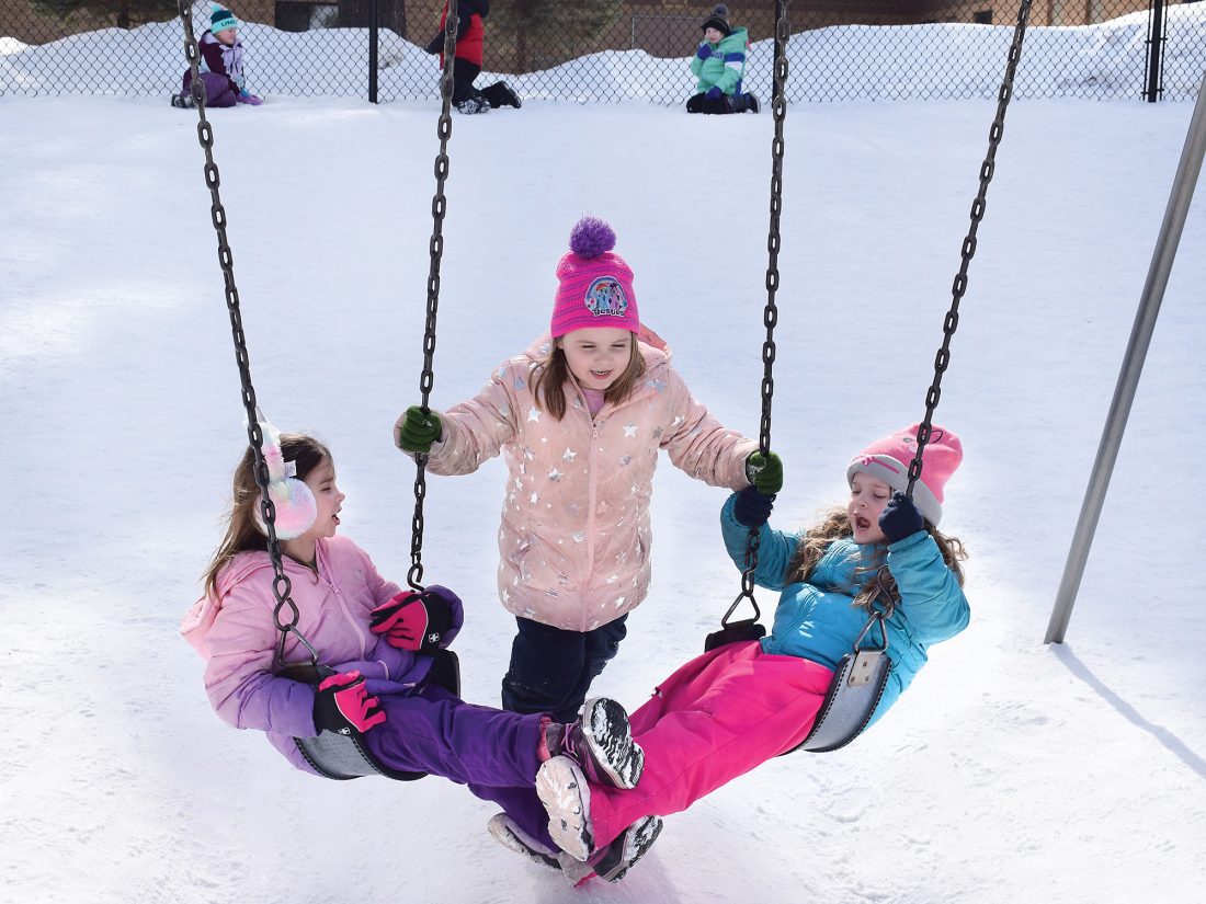
KINDERGARTEN STUDENTS AT Norway Elementary School — from left, Ava Peterson, Payton Parsons and Saphronia O’Brien — sing “London Bridge Is Falling Down” while enjoying their recess time on the playground Friday. A relatively nice Friday was expected to give way to freezing rain, rain and perhaps snow this weekend. (Terri Castelaz/Daily News photo)
IRON MOUNTAIN — A clash between chilly air to the north and warm air to the south is expected to deliver a mix of snow or rain this weekend, with chances for freezing rain prompting a winter weather advisory from the National Weather Service in Marquette.
The advisory is in effect until 4 p.m. today throughout the central Upper Peninsula, including Dickinson, Delta and Menominee counties. Freezing rain could lead to ice accumulations up to 0.2 inches.
“Difficult travel conditions are possible,” NWS forecasters said. “Prepare for possible power outages.”
Rain, snow or freezing rain could continue into Sunday, with wind gusts as high as 30 mph. About an inch of snow could fall locally. Highs in the mid-30s are expected today and Sunday.
Conditions should calm by Monday, with a high near 32.
March 20 will mark the start of the spring season, but daily high temperatures may not climb into the 50s until early April, forecasters say.
The flood risk for the central Upper Peninsula this spring is lower than usual, due to a dry fall, average snowfall and deficient soil moisture, the NWS said. The wild card is spring rainfall and temperature swings as stream flows across the U.P. are running near normal or even below.
A long-range forecast from the Climate Prediction Center suggests normal precipitation and a slightly elevated chance of warm weather over the next three months.
AccuWeather, meanwhile, predicts a moderate risk of severe thunderstorms through May. The storm systems are expected to track across the Midwest and Northeast, meteorologist Paul Pastelok said.
“April looks like a very active month,” he said, adding more than 200 tornadoes are projected to touch down, mostly across the central U.S.
Today’s storm system could bring severe weather to the central Midwest. Cities at risk for severe thunderstorms — including an isolated tornado — include Des Moines, Iowa, and Omaha, Neb., AccuWeather meteorologist Alex Sosnowski said.
Downpours are possible overnight in Chicago, Milwaukee, and Minneapolis, he added.
After a snowy December, the local winter turned cold and relatively dry. Temperatures in February averaged 12.4 degrees at the Iron Mountain-Kingsford Wastewater Treatment Plant, about 4 degrees below normal. January temperatures had averaged 8.9 degrees, about 5 degrees below normal.
Snowfall in February measured 7.8 inches, 3 inches below average, after 10.2 inches in January, also 3 inches under the norm.
The season’s snowfall at the end of February stood at 53.5 inches, about 8 inches below what’s typical for an entire winter. A whopping 29 inches of snow fell in December but much of it melted. Snow depth at the end of February at the treatment plant was 17 inches.
Water-equivalent precipitation in February measured 0.73 inches, compared with an average of 1.08 inches for the month. The highest temperature last month at Iron Mountain-Kingsford was 40 degrees on Feb. 21 and the lowest was 17 below zero on Feb. 13.
The U.S. Drought Monitor shows moderate drought persisting in all Wisconsin counties along the Upper Peninsula border, extending into all of Menominee and Gogebic counties and parts of Dickinson, Iron, Delta and Ontonagon counties. There is no drought concern in the rest of the Upper Peninsula, except for the eastern end.
La Nina continues to be the major driver of the predicted climate, NWS forecaster Dan Collins said. La Nina, a periodic cooling of the central Pacific, is expected to last through May, with a transition to neutral conditions thereafter.
The climate model calls for about a 40% chance of above-normal temperatures in northern Wisconsin and the central U.P. through May and a 25% chance of below-normal.
Jim Anderson can be reached at 906-774-3500, ext. 226, or janderson@ironmountaindailynews.com.
Local News
Highway 180 project begins July 20 in Marinette County
MARINETTE, Wis. — The Wisconsin Department of Transportation Northeast Region will have construction and full ...
Township, county, school meetings scheduled
Iron Mountain Planning Commission will meet at 3:30 p.m. today at Iron Mountain City Hall. Florence County Board ...
DOT starts M-95 culvert project in Marquette County
ISHPEMING — The Michigan Department of Transportation is investing about $88,000 to replace a culvert on M-95 ...

Kaleidoscope Jos performs Thursday in IM and Norway

Controversy in Houghton County over float that appears to depict ICE