
Comments on Michigan’s forest road maps due Aug. 31
Trending
IRON MOUNTAIN -- The Michigan Department of Natural Resources is accepting comments on its 2023 forest road maps through the end of August.
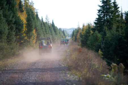
To make sure people know which forest roads are open or closed to public use, the DNR annually updates online maps on April 1 as part of its review process. The update helps the DNR keep its forest road inventory accurate and meet requirements outlined in Public Act 288 of 2016.
Comments on forest road maps may be submitted at any time. Feedback received by Aug. 31 will be considered when developing the 2023 maps.
Updates may include decisions to open or close a road to ORV or conventional vehicle traffic, or to update a road's status.
About 11,700 miles of forest roads currently are open to the public.
The status of forest roads can be viewed and comments submitted on an interactive map at Michigan.gov/ForestRoads, or comments can be emailed to DNR-RoadInventoryProject@Michigan.gov.
Upper Peninsula Recreational Off-Road ATV Riders, or UPROAR, will have their next monthly meeting at 7 p.m. Tuesday, Aug. 16, at Big 10 Sports Bar & Grill in Quinnesec.
Weigh-ins for today's Cedar River Salmon Slam will take place after 3 p.m. in the Oar House behind the Halfway Bar & Grill in Cedar River. Prizes will be awarded at 4 p.m.
The Michigan DNR reported this Upper Peninsula activity:
Little Bay de Noc: Walleye anglers reported slow fishing with some anglers targeting Black Bottom and the Narrows. Perch anglers were having good success around Butlers Island. Anglers targeting smallmouth were catching fish throughout the bay while casting soft plastics. Northern pike were caught near the water treatment plant.
Manistique: Salmon anglers reported fair to good fishing. Anglers were targeting areas near the red can and Pointe aux Barques. Flasher flies and spoons were both catching fish. Walleye anglers were having some success in the river.
Marquette: Anglers fishing in the Marquette area reported catches of lake trout. The best areas for lake trout were around Shot Point and near White Rocks. For Shot Point, try trolling in 50 to 70 feet of water while using multi-color spoons or flickers. For fishing around White Rocks, try trolling in 150+ feet of water while using colorful spoon combinations. Anglers jigging with cut-baits were also successful in deep water near white rocks.
Carp and Pine rivers: Walleye fishing was up and down in both rivers on a given day, but the Pine River seemed to be producing more fish. There were more perch located at the Pine River, especially near the mouth and there were more pike at the Carp River, especially downstream of the fishing dock.
Munising: A few boats were targeting splake/salmon and reported very slow fishing. Boat anglers also reported good catches of lake trout towards Wood Island.
Grand Marais: Very low fishing pressure with only a few anglers making casts off the pier with no results. A few of the charters and one local boat did report some nice limits of lake trout mainly fishing west towards the Hurricane and AuSable area.
Keweenaw Bay/ Huron Bay: Anglers were catching a fair number of lake trout while fishing in the deeper waters of Keweenaw Bay and Huron Bay. Some anglers were also fishing successfully for smallmouth bass and northern pike in the near shore waters of both bays. Anglers anticipate coho moving into the bay in the coming weeks.
Au Train: Anglers fishing the Au Train area had success catching lake trout. Lake trout was the only species reported from anglers fishing out of the Brownstone Boat Launch. The best area to fish was around Au Train Island while fishing the flats or fishing deeper water. Try finding water depths of 100 to 170 feet for best success. Anglers trolling spoons or jigging cut-baits in deep water reported the best success with catching lake trout.